If you read nothing else
- Around sixteen million years, laid down before the rest of the country existed.
- The peninsula sits well off the active zone. No lava fields, no steam.
- Glaciers cut the fjords and planed the mountain tops flat.
- In an area the size of a small country, and falling.
The oldest ground in a very young country
Iceland is a new island by geological standards, still being built along a mid-ocean ridge that runs through the middle of it. The rock at the ridge is being made now. The further you go from it in either direction, the older the ground gets.
The Westfjords are as far from that ridge as it is possible to get in Iceland, and the basalt here is around sixteen million years old, the oldest exposed rock in the country. It was laid down flow by flow, an eruption at a time, in a place that was then the active zone and has since drifted away from it.
You can see that history from the coach. The mountain walls are horizontally striped, and each stripe is one lava flow with a weathered layer on top of it. Count them and you are counting eruptions.
The part of Iceland with no volcanoes
This surprises people, because Iceland means volcanoes to most visitors. The Westfjords have none that matter.
There is no active volcanism here, no recent lava field, no fissure and no geothermal power station of the kind that supplies the south. The dramatic black landscapes people expect from Iceland are hundreds of kilometres away.
What is here instead is very old, very hard, very stable rock, and the effect is a completely different kind of country: green rather than black, rounded and terraced rather than raw, and quiet in a geological sense as well as a human one.
There are hot springs, which come from deep circulation rather than a magma chamber underneath, and one or two of them are famous. But the Westfjords are the part of Iceland where the ground is not doing anything, and that is a large part of their character.
It also means the region missed out on the geothermal wealth that heats the rest of the country almost for free, which is one more reason the population went south.
Horizontally striped basalt walls above a still fjord
Why the map looks like a hand
The shape is entirely the work of ice.
During the glaciations, thick ice sat on this block of basalt and moved outward towards the sea. Ice flowing downhill in a valley cuts it deeper and squarer than water ever does, and where the ice reached the ocean it carved below the waterline. When it melted, the sea came in and filled the trenches, and those trenches are the fjords.
The flat tops are the other half of the story. The high ground between fjords was planed off rather than sharpened, leaving broad tables at a similar height across the whole region, which is why the skyline here is level rather than jagged.
So the hand-shaped peninsula on the map is a block of layered lava with deep parallel grooves cut into it from every direction, and the fingers between the grooves are what is left.
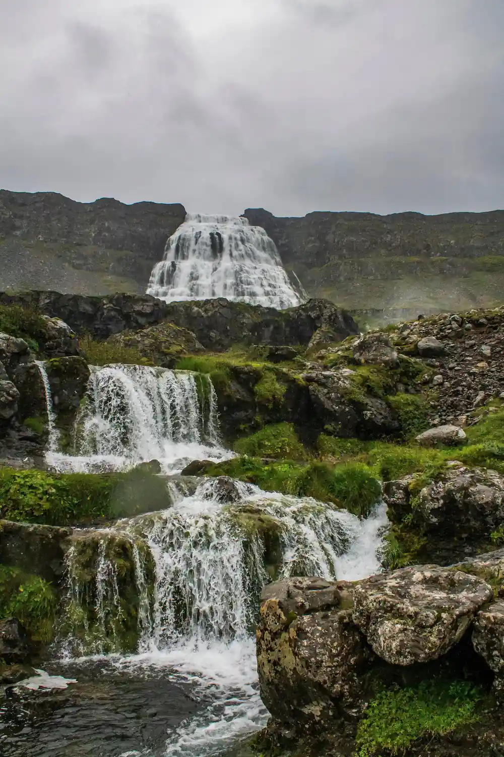
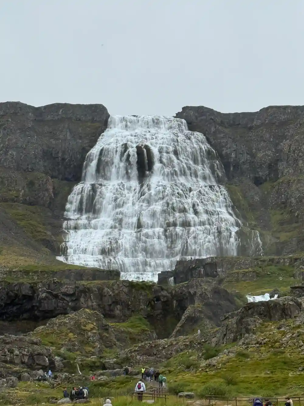
Dynjandi sits at the head of one of those trenches, pouring off the edge of the old flat land into a fjord that was not there when the river first started running.
Seven thousand people
The Westfjords hold around seven thousand residents, roughly two per cent of Iceland's population, in a region that is a substantial fraction of the country's area.
It was not always this thin. When fishing was done from small boats, every fjord with a landing place supported people, and the region was one of the more populous parts of the country. Larger vessels, then quotas, then the pull of Reykjavik reversed that over the course of a century.
Ísafjörður, with around two and a half thousand people, is the largest town. After that the settlements are villages of a few hundred, and between them are long stretches with nothing but sheep.
The effect on a visitor is immediate and hard to get from a photograph. You can stand at a hundred-metre waterfall, look around, and see no building of any kind.
The other thing you notice is how far apart the settlements are. Villages here are separated by mountain roads and headlands rather than by a few minutes of driving, and each one has had to be more self-sufficient than its size suggests.
16 million
The age in years of the basalt in the Westfjords. It is the oldest exposed rock in Iceland, and every stripe on a mountain wall is a separate eruption.
Why so few visitors get here
Iceland receives an enormous number of visitors and almost all of them go to the same places: the south coast, the Golden Circle, the capital region and the north around Akureyri.
The Westfjords get a small fraction of that, for the simple reason that they are a long detour from every ring-road itinerary. Driving here from Reykjavik takes most of a day, the roads inside the region are slow, and a visitor with a week has to give up a great deal of the standard route to include it.
Which is why a cruise call at Ísafjörður is a genuinely good deal. A ship puts you in the middle of the region for a day without any of the driving, and a four-hour excursion reaches its single most impressive natural feature.
It is also why Dynjandi, a waterfall that would be mobbed anywhere else in the country, is somewhere you can still hear yourself think.
The oldest, emptiest, quietest corner of Iceland
from US$144Reserve now & pay later